|
|
|
| The Family Tree of J. Edward Tuck, Jr. | |||||||||||||||||||||||||||||||||||||||||||||||||||||||||||||||||
| Home > Map Index > Tidewater Region, Virginia | |||||||||||||||||||||||||||||||||||||||||||||||||||||||||||||||||
| || Page 1 | Page 2 || | |||||||||||||||||||||||||||||||||||||||||||||||||||||||||||||||||
| Tidewater Region, Virginia | |||||||||||||||||||||||||||||||||||||||||||||||||||||||||||||||||
| COUNTY
(???) County Lundenburg Halifax Halifax Halifax Halifax Halifax Halifax Halifax Halifax King William |
Earliest TUCK References (YEAR) BENNETT TUCK (1740) - Note In The Journal of the House Of Burgess on June 6, 1740, BENNETT TUCK was mentioned. JOHN TUCK, EDWARD TUCK, ALSO THOMAS TUCK (1752) - Appear in Halifax County about the time it was cut off from Lundenburg, each aquired land. NOTE: Antrim Parish was formed at the creation of Halifax County in 1752 and their boundaries were identical. BENNETT TUCK (1776) - May have been same as the BENNETT TUCK, SR who on 1776, with STEPHEN and ANDREW WADE and ANDREW HUNT, signed a communication from Halifax County to The General Assembly (PETITION OF 1776---Archives Div., Virginia State Library). JOHN TUCK (1759) - JOHN ASHLOCK, a male tithable, ordered by the court to help maintain a road from JOHN TUCK's property to Sparrow's foard on Terrible Creek. Source: Halifax County Virginia Court Orders 1758-1759 (Plea Book No 2, Part 2), Copyright 1998 by TLC Genealogy) JOHN TUCK (1765) - Will of EDWARD POWELL NOTE: MARY TUCK dau. of EDWARD POWELL,also Included in Will. Parish of Antrim County of Halifax JOHN TUCK (1761) (1774) (1780) (1782) (1787) (1788) - years land acquired. EDWARD TUCK (1778) - Witnessed a land sale on April 4, 1778 from THOS. WATKINS to THOS. BINGHAM. (Source: Halifax County Virginia Deeds 1778-1784, Copyright 1992 by TLC Genealogy) EDWARD TUCK (1780) - Will of EDWARD TUCK dated August 14, 1780 JOHN TUCK (1782) - Virginia Personal Property Tax List THOMAS TUCK (1782) - Virginia Personal Property Tax List BENNETT TUCK (1782), JOSEPH TUCK (1782), CARY TUCK (1782), JACK TUCK (1782) - Virginia Personal Property Tax List |
||||||||||||||||||||||||||||||||||||||||||||||||||||||||||||||||
 |
|||||||||||||||||||||||||||||||||||||||||||||||||||||||||||||||||
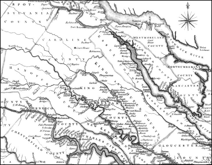
| This computer-enhanced image was created from a map of Virginia published in 1770 by Thomas Jeffreys, London. Click here to view the original map on the Library of Congress historic maps website. | |||||||||||||||||||||||||||||||||||||||||||||||||||||||||||||||||
 |
|||||||||||||||||||||||||||||||||||||||||||||||||||||||||||||||||
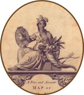
| In 1770, English mapmaker Thomas Jeffreys depicted the Virginia Colony as a bare-breasted Indian maiden bearing a cornucopia of fruit and tobacco leaves, with a portrait of King George III in her lap. |
|||||||||||||||||||||||||||||||||||||||||||||||||||||||||||||||||
|
|||||||||||||||||||||||||||||||||||||||||||||||||||||||||||||||||
 |
|||||||||||||||||||||||||||||||||||||||||||||||||||||||||||||||||
| A stylized drawing of a Tidewater tobacco plantation, 1750. Note the tobacco plants growing up and down the hill, and even on top of the plantation house. The message is clear: in Virginia, tobacco was king. |
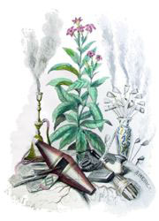
This 19th-century illustration shows a flowering tobacco plant and various smoking implements. | ||||||||||||||||||||||||||||||||||||||||||||||||||||||||||||||||
| Map Index | |||||||||||||||||||||||||||||||||||||||||||||||||||||||||||||||||
| www.tuckgenweb.freeservers.com | |||||||||||||||||||||||||||||||||||||||||||||||||||||||||||||||||